

Two months ago we flagged the Pacific loading up: an event that was borderline at the surface, with an enormous slug of warm water beneath it. The August numbers are in, and the short version is that it's running ahead of the June script.
The August numbers
From NOAA Climate Prediction Center's 13 August ENSO Diagnostic Discussion (the El Niño Advisory remains in effect):
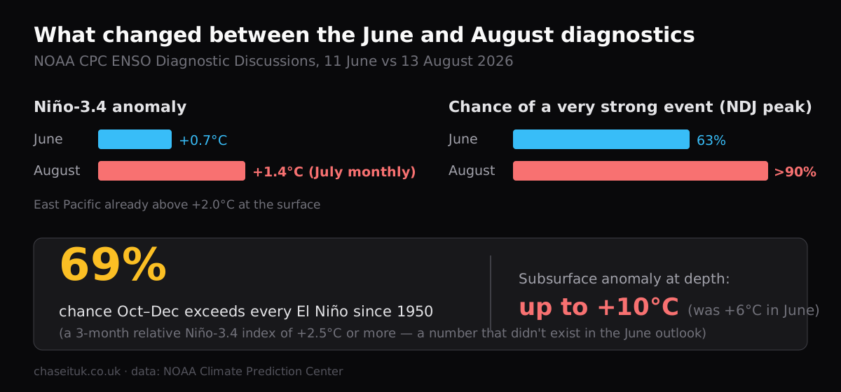
- The monthly Niño‑3.4 anomaly reached +1.4°C in July — double the +0.7°C we reported in June — and parts of the eastern equatorial Pacific are already above +2.0°C at the surface.
- The subsurface heat has intensified rather than spent itself: anomalies up to +10°C at depth, beneath a deeper-than-average thermocline. June's discussion cited +6°C.
- The chance of a very strong event through Northern Hemisphere autumn and winter is now above 90%, up from 63% in June.
- New this month: CPC puts a 69% chance on October–December exceeding every El Niño since 1950 — defined as a three-month relative Niño‑3.4 (RONI) value of +2.5°C or more. That would put 2026‑27 above the 1997‑98 and 2015‑16 "super" events on that measure.
Reading it honestly
The peak is still ahead — late autumn into winter — and a 69% chance of "historic" is also a one-in-three chance it falls short of that bar. The RONI index the 69% refers to is a relative measure, designed to strip out the background warming of the whole tropical ocean; it's the right tool for comparing against 1950s events, but it isn't the same number as the raw Niño‑3.4 anomaly in the bullet above. And seasonal forecasts made in August still carry real spread.
Same disclaimer as June: this is global context, not a UK convective-season forecast — none of it comes from our own sensors.
The UK angle (unchanged)
ENSO's fingerprint on northwest Europe remains weak and indirect, and nothing in the August diagnostics changes that. The reliable impacts stay where they were: the southern US, Australia and Indonesia, a quieter Atlantic hurricane season, and a measurable bump to global temperature into 2027. The place a UK signal would first show up is the winter contingency outlooks issued from late autumn — we'll be watching those, and the next CPC discussion lands around 11 September.
Sources: [NOAA Climate Prediction Center ENSO Diagnostic Discussion](https://www.cpc.ncep.noaa.gov/products/analysis_monitoring/enso_advisory/ensodisc.shtml) (13 August 2026). Figures current as of 25 August 2026.
Discussion · 0
Sign in to commentNo comments yet — be the first.
Members can post. Sign in to join the discussion.